


Voting District 0353734000002, Clare County, Michigan
About
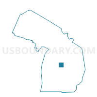
Outline

Summary
| Unique Area Identifier | 596264 |
| Name | Voting District 0353734000002 |
| County | Clare County |
| State | Michigan |
| Area (square miles) | 15.29 |
| Land Area (square miles) | 14.91 |
| Water Area (square miles) | 0.37 |
| % of Land Area | 97.55 |
| % of Water Area | 2.45 |
| Latitude of the Internal Point | 44.01447850 |
| Longtitude of the Internal Point | -84.78314850 |
Maps


Graphs
Select a template below for downloading or customizing gragh for Voting District 0353734000002, Clare County, Michigan


Neighbors
Neighoring Voting District (by Name) Neighboring Voting District on the Map
- Voting District 0350362000001, Clare County, MI
- Voting District 0353512000001, Clare County, MI
- Voting District 0353614000001, Clare County, MI
- Voting District 0353680000001, Clare County, MI
- Voting District 0353716000001, Clare County, MI
- Voting District 0353734000001, Clare County, MI
- Voting District 0353734000003, Clare County, MI
- Voting District 0353734000004, Clare County, MI
- Voting District 0354762000002, Clare County, MI
Top 10 Neighboring County Subdivision (by Population) Neighboring County Subdivision on the Map
- Hayes township, Clare County, MI (4,675)
- Harrison city, Clare County, MI (2,114)
- Hamilton township, Clare County, MI (1,829)
- Lincoln township, Clare County, MI (1,824)
- Greenwood township, Clare County, MI (1,041)
- Hatton township, Clare County, MI (933)
- Arthur township, Clare County, MI (647)
Top 10 Neighboring Place (by Population) Neighboring Place on the Map
Top 10 Neighboring Unified School District (by Population) Neighboring Unified School District on the Map
- Harrison Community Schools, MI (13,040)
- Farwell Area Schools, MI (11,142)
- Clare Public Schools, MI (8,546)
Top 10 Neighboring State Legislative District Lower Chamber (by Population) Neighboring State Legislative District Lower Chamber on the Map
Top 10 Neighboring State Legislative District Upper Chamber (by Population) Neighboring State Legislative District Upper Chamber on the Map
Top 10 Neighboring 111th Congressional District (by Population) Neighboring 111th Congressional District on the Map
Top 10 Neighboring Census Tract (by Population) Neighboring Census Tract on the Map
- Census Tract 8, Clare County, MI (4,283)
- Census Tract 13, Clare County, MI (3,992)
- Census Tract 7, Clare County, MI (3,272)
- Census Tract 10, Clare County, MI (2,809)
- Census Tract 9, Clare County, MI (2,000)